 Station N (1) Bay of Isles
A small expedition consisting of W. N. Bonner and B. Stonehouse, funded by Falkland Islands Dependencies Government and administered by FIDS, did allocate letter ”N” to the station set at 54°03’South, 37°23’West, at Ample Bay, Bay of Isles, South Georgia . The initial though, even if that was later considered a private expedition, Station N (1) was set to study Biology and was occupied from 1953 through 1955.
The buildings consist in a main hut and small store hut. Main hut had burnt down by 1974. Debris were removed in the Antarctic season 2005/06.
(Thanks and credit: https://www.bas.ac.uk/wp-content/uploads/2015/03/British-Antarctic-Stations-Refuges-v6.2-2016.pdf )
Station N (“2”) Anvers Island (WAP GBR-28) & Old Palmer Station (WAP USA-33)
 On Anvers Island, the British Antarctic Survey built and operated a Station (Base N “2”) Anvers Island at Arthur Harbour, 64°46’ South, 64°05’ West, with purpose of survey and geology. (Pic aside show the Base as it was in 1955)
It was occupied from 28 Feb. 1955 until 10 Jan. 1958. Closed in 1958 when local work completed. Pic aside show Base N, Anvers Island, 1955-56. (Photographer: Alexander Rennie; Archives ref: AD6/19/3/C/N1)
Thanks and credit to: https://www.bas.ac.uk/about/about-bas/history/british-research-stations-and-refuges/anvers-island-n/
 The Hut at Station (Base N “2”) was loaned to the U.S. Government on July 2, 1963, which converted it into a biological laboratory and added a new building (the red one on the pic aside) in January 1965 for use by American scientists at the nearby Palmer Station.
Palmer Station “Old” (WAP USA-33) and “New” (WAP USA-23)
 The actual facility (WAP USA-23) at 64°46’27” South, 64°03’10” West is practically the second Palmer Station and it’s located on Anvers Island (pic to the left).
“Old Palmer” (WAP USA-33) built about 1965, was about half a mile to the northwest adjacent to the site of the British Antarctic Survey “Base N”, built in the mid-fifties. The site is on what is now known as Amsler Island. Rapid recession of the ice due to global warming revealed Amsler Island as a separate island in 2004.
Amsler Island was the original site of the United States Antarctic Program research base Palmer (Old Palmer, WAP USA-33) from 1965 until the current station approximately 0.8 km (0.5 mi) away was constructed in 1968.
 WAP USA-33, “Old Palmer” (Pic to the right) served as a base for those building “New Palmer”, which opened in 1968. Old Palmer was designated as an emergency refuge for the new station in case of disaster, though this perceived need disappeared over time. It was dismantled and removed from the Antarctic as part of the National Science Foundation’s environmental cleanup efforts in the early 1990s. According to Mehdi F5PFP, Old Palmer Station at Arthur Harbour was active on air by KC4AAC 1963 & KC4USP 1965 .
WAP did issue a separate reference to “Old Palmer Station” at Anvers Island/Amsler Island 11 years ago (2009) to recognize the two distinct evolution phases of the history of both Palmer Bases .
 Station N (2) was re-open by the British in support of air facility 1969-1971 (pic to the left).
On 28 Dec 1971 the station has been destroyed by fire while being renovated by BAS. Debris was removed by the members of the US Antarctic Program in 1990/91. Only concrete foundations remain.
The Skiway on Marr Ice Piedmont was used 1969-1973 and then intermittently until 15 Nov 1993, and once in Dec 1999.
Air operations have been transferred to Adelaide (Station T) WAP GBR-13 in 1973 when the skiway found deteriorated.
 On Tuesday Dec. 22, the German Research Icebreaker Polarstern left the port of Bremerhaven. On board YL Theresa DC1TH and Felix DL5XL. They are now on the way direct down to Antarctica. DPØPOL/MM has already been reported QRV on 20 mts CW.
 PCR swab tests given to Chilean researchers at the General Bernardo O’Higgins Riquelme (pic aside) came back positive.
 Despite the current situation, the Czech Antarctic Research Program will continue with field research. An eight-member team has departed from Prague on Wednesday, December 16th to Chile, where they will quarantine at a hotel, before heading on to
  The expedition will be led by climatologist and polar explorer Kamil Láska from the Department of Geography, at Masaryk University’s Faculty of Science. The operation of the station will be overseen by technicians from Czechoslovak Ocean Shipping, František Vorel and Tomáš Spáčil.
 The vessel, known as ‘Orange Roughy’, completed its last trip among the long list of its scientific expeditions for the Australian Antarctic Division on Dec 12.
 Located at 82°00’ South, 155° 00’ West, Siple Coast is the middle portion of the relatively ill-defined coast along the East side of the Ross Ice Shelf. Siple Coast is the grounding line of the West Antarctic Ice Sheet, where the ice meets the ocean and starts to float, becoming the Ross Ice Shelf. It is as far south as the ocean reaches anywhere in the world.
 (See location 862AB on the map) This season’s main objective is to develop an understanding of the nature of the sea-floor sediments. Future retrieval of deep sediment cores will help inform multidisciplinary studies of the stability of the Ross Ice Shelf during past warm periods. Drill holes at the Siple Coat will also support the United States Icefin project. Icefin is an under-ice robot designed to explore ice-ocean environments here on Earth and ultimately on Jupiter’s icy moon named Europa.
 Station N (1) Bay of Isles
  On Anvers Island, the British Antarctic Survey built and operated a Station (Base N “2”) Anvers Island at Arthur Harbour, 64°46’ South, 64°05’ West, with purpose of survey and geology. (Pic aside show the Base as it was in 1955)
 The Hut at Station (Base N “2”) was loaned to the U.S. Government on July 2, 1963, which converted it into a biological laboratory and added a new building (the red one on the pic aside) in January 1965 for use by American scientists at the nearby Palmer Station.
 The actual facility (WAP USA-23) at 64°46’27” South, 64°03’10” West is practically the second Palmer Station and it’s located on Anvers Island (pic to the left).
 WAP USA-33, “Old Palmer” (Pic to the right) served as a base for those building “New Palmer”, which opened in 1968. Old Palmer was designated as an emergency refuge for the new station in case of disaster, though this perceived need disappeared over time. It was dismantled and removed from the Antarctic as part of the National Science Foundation’s environmental cleanup efforts in the early 1990s. According to Mehdi F5PFP, Old Palmer Station at Arthur Harbour was active on air by KC4AAC 1963 & KC4USP 1965 .
 Station N (2) was re-open by the British in support of air facility 1969-1971 (pic to the left).
 WAP
WAP Lee sent us some pics which we are happy to share with the readers. After stopping by at Jangbogo Station (WAP KOR-Ø2) Lee is expect to reach King Sejong Base (WAP KOR-Ø1)at beginning of January for a long stay.
 The ice-breaking research vessel Araon was built in 2009 and is sailing under the flag of Korea. She did explore the South and North Pole regions on several missions since 2009 as part of global efforts to examine the cause of global warming and study the Arctic & Antarctic ecosystem.
 Icebreaker AKADEMIK TRYOSHNIKOV (IMO 9548536, MMSI 273359440, Callsign UBXH3) was reported two days ago by MarinecTraffic Terrestrial Automatic Identification System as sailing in the Atlantic Ocean.

 As part of the seasonal work of
 Antarctica has been called “the continent without language”. True languages are spoken only by human beings, and although there are many visiting scientists and support workers in Antarctica these days, this is a modern situation: the continent has never had indigenous languages because it has never had an indigenous human population.
 Organizing an Antarctic expedition in the times of COVID19 is quite a challenge, so the German Polar Institute (AWI) had to find a different approach to the logistics for the upcoming Antarctic summer season. All transports will be carried out by ship directly from Germany. There is only a small team of about 20 technicians and scientists travelling to Neumayer III Station (WAP DEU-Ø8), this year. YL Theresa, DC1TH and Felix, DL5XL will be part of that group.
 While the French Minister of Research greets the new coming personnel involved in the new Antarctic season at the French-Italian Station, the winter-over did end at Concordia (WAP MNB-Ø3) with the arrival of the first flight from MZS (WAP ITA-Ø1).

 Over the last three years, satellite missions such as Copernicus Sentinel-1 have been used to track the berg as it has drifted in the Southern Ocean. For the first two years, it remained close to its parent ice sheet, impeded by sea ice. But now, as the map shows, the main chunk of the A-68 berg, known as A-68A, is heading rapidly for South Georgia. It is now about 350 km from the island.
 Sir David Attenborough (IMO: 9798222, Callsign ZDLQ3 ) is a Research Vessel registered and sailing under the flag of Falkland Islands. Her gross tonnage is 15000 and deadweight is 5000. Sir David Attenborough was built in 2018/2020.. Her container capacity is 0 TEU. The ship is operated by British Antarctic Survey .
 Southgate Amateur Radio News reports that, on November 3, 2020, German TV broadcaster WDR aired a news story about radio amateur Theresa DC1TH who is part of the Neumayer-III Base 2021/22 overwintering crew.
  On November 6th, Chile has celebrated the “Chilean Antarctic Day”. WAP join the event and share it with all the women and all the men who love Antarctica and dream of the White Continent.
 Also known as Rasmussen Point, this Hut is located at 65°15’South, 64°06’West on Rasmussen Island in the North part of Waddington Bay, Graham Coast in Antarctica.
 cloud and aerosol instrumentation, has a meteorological relationship with the West Antarctic Ice Sheet (WAIS) via circulation patterns in the Ross and Amundsen seas.
 In a message just received,
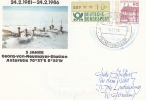


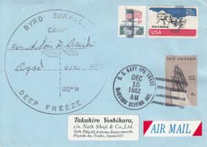
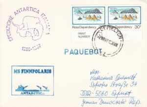 Beginners may have noticed, some cover with a handstamp of
  Korea’s Antarctic Scientific Base King Se-Jong (WAP KOR-Ø1). on King George Island, South Shetlands 62°13′ 26″ South, 58°47′ 27″ West
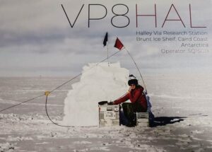 Seba SQ1SGB will sail to Halley VI(a) Base next December. He hopes to be active for 5 weeks, starting beginning of January 2021.
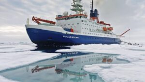 For a year the German icebreaker “Polarstern” was on a MOSAiC expedition in the Arctic to study the effects of climate change. In the early morning of October 12th, R/V Polarstern of the Alfred Wegener Institute for Polar and Marine Research is finally back in its home port of Bremerhaven.
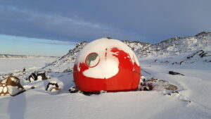
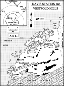 The Hut, 68°28’18”South, 78°11’16”East, is temporarily moved to the sea ice near the Plough Island skiway for up to 2 months in summer, then returned back to Ace lake.
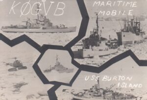 A rare old QSL of KØGVB/MM forced us to know a bit more about USS Burton Island (AGB-1), an icebreaker with a long and intense story. It could be that some Old Timers did work KØGVB/MM from 1967 and up, that was a great time to contact such a rare ones!
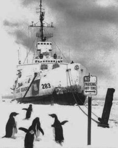 navigation, clearing channels through the ice for supply vessels, laying cables, delivering and dispatching the U.S. Mail at remote stations and vessels, search and rescue, fisheries patrol, law enforcement.
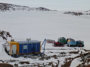 The Browning Peninsula Refuge (66°28’10” South, 110°33’00” East) is 21 km due south of Casey Station (WAP AUS-Ø2).
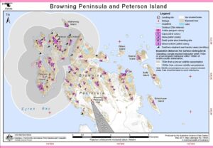 Browning is the furthest of the huts around Casey Station at about 60 km from station by GPS route. The area around Browning is spectacular with lots of hills, rocks and lakes. The Hut can sleep 6 people.
 A new earthquake of significant magnitude occurred on Monday afternoon (oct. 5, 2020) in Argentina’s Antarctica, reported the National Institute for Seismic Prevention (INPRES) based in San Juan.
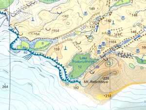
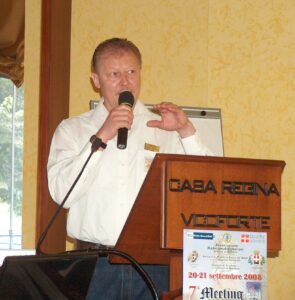 Thanks to Dr. Volker Strecke DL8JDX (ex Y88POL) a well known German Antarctic veteran (pic aside), WAP is now able to retrace the history of two unknown Huts, later joined and became a Refuge.
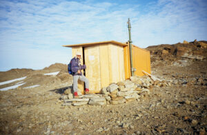 Lake Podprudnoye Hut, (
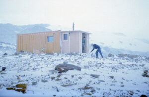
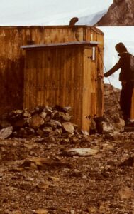 A decision decision to join Lake Podprudnoye Hut with the other hut moved from Lake Prilednikovoye was taken in the Antarctic summer season 1988-1989 .
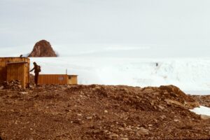 Picture aside shows both huts together.
 Radio Club Ushuaia is very grateful to the Hams that have operated from September 25 to 30 in a special radio event to celebrate 60 years anniversary of the creation of “Tierra del Fuego National Park” together with a tribute to the people who work every day to conserve and beautify this beloved national park Tierra del Fuego.
 Also known as Reclus hut or Portal Point this Refuge was located at 64°30’ South, 61°46’ West , at Portal Point, Reclus Peninsula, Danco Coast, with survey and geology purposes.
 Pic on the right shows Cape Reclus refuge, 1957-58. (Photographer: Richard Foster; Archives ref: AD6/19/2/O3/2)
 the Falkland Islands Museum, Stanley, Falkland Islands. (Erected as an exhibit Dec 1998, refurbished Nov 2007, re-built inside the new Museum 2014.)
 For 17 years now, without interruption, Hams from Italy and few others coming from neighboring European Countries have joined a Multi Program Meeting in Northen Italy at the foot of the Alps.
 Antarctica and WAP have been carried on by Max IK1GPG and Betty IKQFM who shown the results obtained in terms of rankings and diplomas awarded to Ham radio fans of Antarctica from all over the world.
 WAP Awards, Antarctic bulletins, Directories, regular information posted on WAP website, are just some of the goals to which we are proud also because everything has been put online for free. Our passion to the Icy Continent makes us forget the fatigue and we are always comforted by the satisfaction of knowing that there are many of us in the world with the same passion. Thanks to the hundreds radio amateurs and friends who have collaborated and continue to collaborate with us, providing news and information.
 Happy National Holiday Chile
 It was the location of the British research Station “V”, which was active intermittently from June 3, 1953 to November 25, 1963 and called Seal-catcher’s Arms or View Point Hut, with the intention of searching in the survey, meteorology and geology. Established as a satellite base for Hope Bay (Station D) WAP GBR-Ø4 , the construction of the first hut started on June 3, 1953, the second was established on March 20, 1956.
 The battle to keep Antarctica free of coronavirus will see Australian expeditioners spend up to an extra four months on the ice-covered wilderness.
 Donning a headset, people are invited to step inside Hillary’s Hut and to explore the first building at what is now New Zealand’s Scott Base (
 With more than 30 years of experience, ALE (
 NCPOR condoles the death of Dr. Vilas Jogdand, Leader of Maitri Station during the 35th Indian Scientific Expedition to Antarctica (2015-16).
 Hope Point, 54° 17′ South, 36° 29′ 15″ West, is a rocky bluff, 20 meters (70 ft) high, which forms the north side of the entrance to King Edward Cove.
 off on the expedition thinking the body was bound for England.
 Reconstruction of the Vostok II Station, the only inland Antarctic station used by Russia, is scheduled to be completed by 2024.
 The Refuge, is one of the 18 shelters that are under the responsibility of Esperanza, which is responsible for the maintenance and the care. It has capacity for 12 people, food for two months, fuel, gas and first aid kit. It has been used in some Argentine scientific campaigns and ordinary patrolling. The main scientific observations are the geology and topography of the area, the sea ice and survey on the Crabeater seal and the Weddel seal.
 After four months of darkness, the sun finally rises on 11 August at Concordia Research Station (
 From page 789 and ahead, the newest Edition of the Funkamateur includes four Antarctic-related articles
 Penguin populations are usually associated with the polar ice caps, most likely originating from Antarctica. A team of scientists from Berkley University of California has determined that penguins first lived in Australia and New Zealand nearly 22 million years ago.
 Blood and tissue samples allowed scientists to trace back how penguins became diverse throughout millions of years, and how they moved south to Antarctica. They believe that the emperor and king penguins left their ancestors and migrated to Antarctica due to the abundant supply of food available. These two specific penguin species have caused experts to debate about where they fit in the penguin family tree and are believed to belong to a ‘sister group
 Mawson Base (WAP AUS-Ø4) and 5 km north-east of Taylor Glacier on an island in the Colbeck Archipelago. Established in 1988, it is used as shelter for visitors to the Taylor Glacier area, including to monitor the Taylor Glacier emperor penguin colony in ASPA 101. It can only be accessed over fast ice or via rotary wing aircraft. The refuge can accommodate four persons. It contains medical facilities such as comprehensive first aid kit, food and fuel for heating, lighting, and cooking (either kerosene or LPG)
 The 74th India Independence Day celebrations has been a great moment at Maitri Indian Research Base in Antarctica (WAP IND-Ø3).
 Going back to Felix report, the Ham Radio Station is up and running, so Andreas, DL3LRM, will be active in CW signing DP0POL/MM on 40m, 30m, and 20m from various locations near the North Pole. QSL via DL5EBE